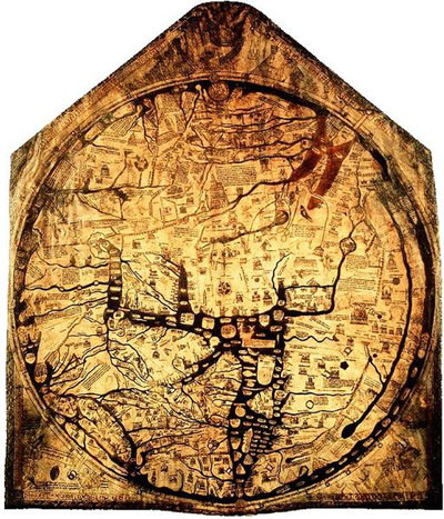
Figure 1. Hereford Mappa Mundi ca. 1285
The Hereford Mappa Mundi is a map of the world created sometime around the late 13th century. It was drawn onto an animal hide and is displayed in Hereford, England, near the Welsh border. It is by far the most impressive extant map of its kind.
The map itself is typical of Medieval Christian cartography in that it is oriented to the east with Jerusalem and an enlarged Holy Land in the center, and paradise in a circle at the top. Much of the remaining area informed by biblical and classical sources, with ample illustrations and notes. It is as much a spiritual piece as a work of geography.
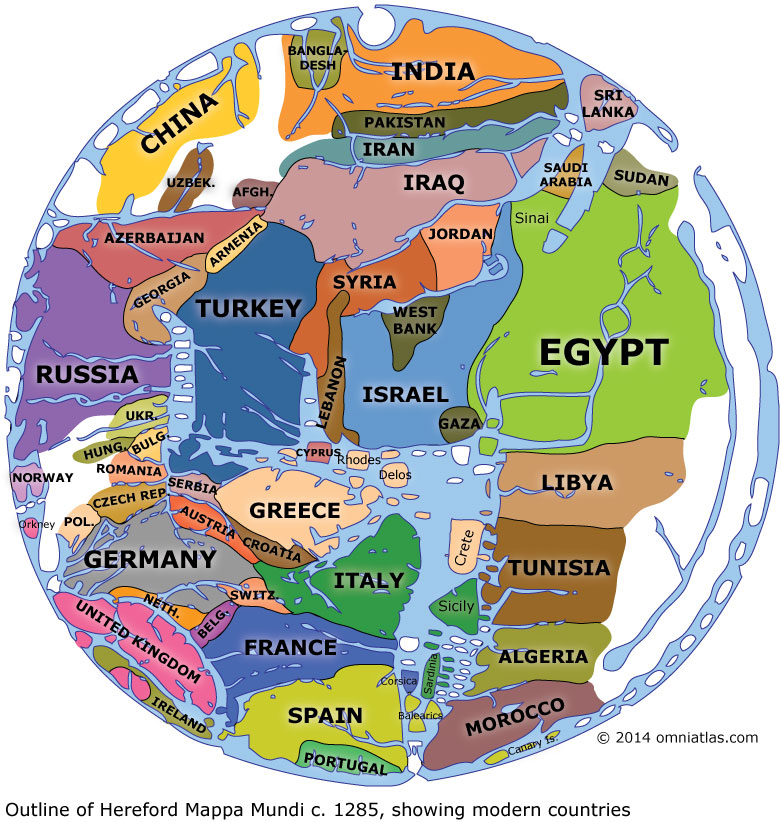
As it's still fairly difficult to see what's where, I've transcribed the map with the addition of modern countries and borders below. Naturally there's an element of guesswork in this translation - where I've given up completely, the land is colored white. Elsewhere, I've used cities, rivers, seas, and classical place names to determine what lies where.
For more on the Mappa Mundi, visit Hereford Cathedral, the Mappa Mundi website, or read Jerry Brotton's excellent A History of the World in Twelve Maps (on Amazon).
